16 September 2026
Hillforts, and What the Rings Are Actually For
If you have walked up a hill in Britain and found yourself stepping over a grassy bank, then down into a hollow, then up over another bank, you have almost certainly walked into a hillfort.
There are a lot of them. The Atlas of Hillforts of Britain and Ireland recorded more than 4,000. Most were built between roughly 800 BC and the Roman invasion, although some are older, and almost all of them follow the same idea: a hilltop enclosed by one or more banks with a ditch in front.
The rings are one thing, built once
The bank and the ditch are not two separate features. They are the same job. You dig a ditch, you throw the material inwards, and the bank is what you dug out. That is why the ditch is almost always on the outside: an attacker coming uphill drops into the ditch and then has to climb a bank that is effectively twice as tall as the material in it would suggest.
Most hillfort banks looked very different when they were new. Many were faced with timber, or revetted with stone, or topped with a palisade. What survives now is the slumped core of that structure after two and a half thousand years of weather, so a rampart that reads as a gentle grassy swell was once a wall you could not climb.
One ring or four
The word archaeologists use is univallate for a single line of bank and ditch, and multivallate for more than one. It is worth knowing because it is how these sites are described in the official records, including in Visit History. Uffington Castle's entry on the National Heritage List, for instance, calls it "a univallate hillfort immediately north of the Ridgeway on Whitehorse Hill".
Here it is in the terrain model, with the single circuit running right round the hilltop.
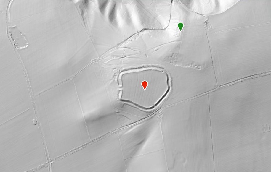
Uffington Castle. One bank, one ditch, all the way round.
From directly above, in ordinary aerial imagery, the same hilltop is a pale smudge in a green field.
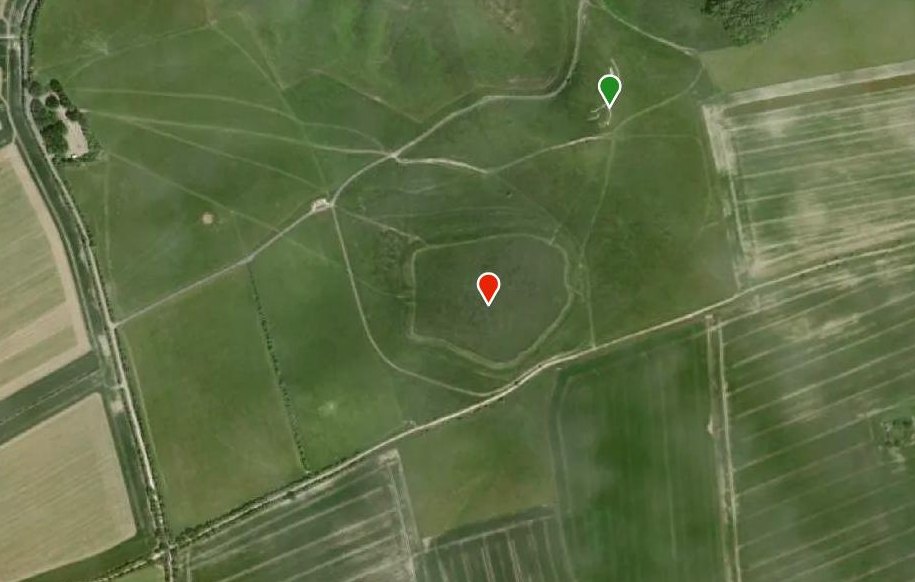
Maiden Castle in Dorset is the other extreme, and it is the largest Iron Age hillfort in Britain. On its southern side the ramparts run three and four deep.
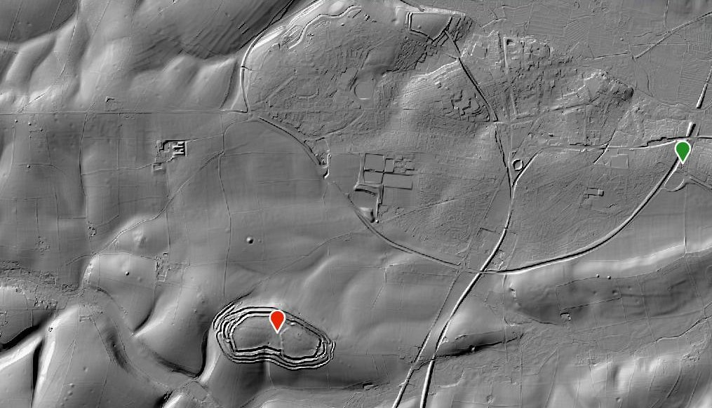
Maiden Castle is the ringed shape at the bottom left. The rest of the frame is Dorchester and the earthworks under the fields around it.
More rings is not simply more defence. Multivallate forts tend to be later, and the extra circuits are often widest and most elaborate on the side that faces the easiest approach, which is also the side most people would see. Whether that is about stopping an attack or about being visible from a long way off is a real argument among archaeologists rather than a settled question.
Watch the entrances
The gate is the weak point, and it is usually where the builders spent their effort. Look for the banks turning inwards to form a corridor, so anyone coming in has to walk between two ramparts with people above them on both sides. Some forts have staggered entrances, where you cannot see straight through, and some have outworks in front that force an approach along the wall rather than at it.
If you only look at one thing on a hillfort, look at how the entrance is arranged. It tells you more than the size does.
What were they for
The honest answer is that it varies, and that "fort" is doing more work than the evidence always supports.
Some were clearly defended and some were attacked: there are sites with burnt ramparts and with weapons in the ditches. Others show very little sign of permanent occupation at all, which has led to arguments that they were seasonal gathering places, stock enclosures, storage sites for grain, or statements of status by a family who wanted the valley to see what they could command.
Most were probably several of those things across the centuries they stood. A site that starts as a stock enclosure can end as a stronghold, and quite a few carried on being useful long after the Iron Age ended.
Old Sarum is the clearest example of that. The Iron Age circuit is still the outer ring, and inside it sit a Norman castle and the ground plan of a cathedral that was pulled down from 1226 when the city moved down the hill to Salisbury.
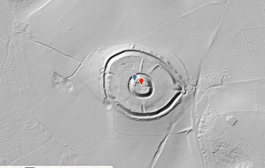
Old Sarum. The Iron Age enclosure, a castle inside it, and a cathedral footprint, all in one hilltop.
Why LiDAR helps so much here
Two reasons.
The first is trees. A hillfort under woodland is nearly impossible to read on the ground or from the air, because the canopy hides everything. The terrain model strips the trees out and leaves the earthworks. Bury Ditches in Shropshire sits under forestry, and its three rings only appear once the trees are gone.
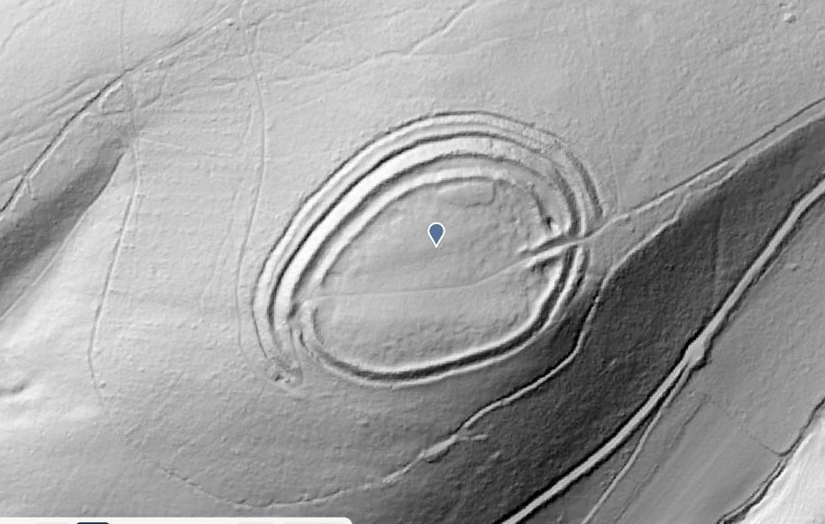
Bury Ditches, with the plantation taken off.
The second reason is everything around the fort. Hillforts did not sit in empty countryside. The fields, tracks and boundaries that went with them are usually ploughed almost flat, too faint to notice from a footpath, and perfectly visible in LiDAR as a web of low lines running across modern field boundaries as though the modern fields were not there. Welshbury in the Forest of Dean is a good one for this, with old field banks stepping down the slope below the rampart.
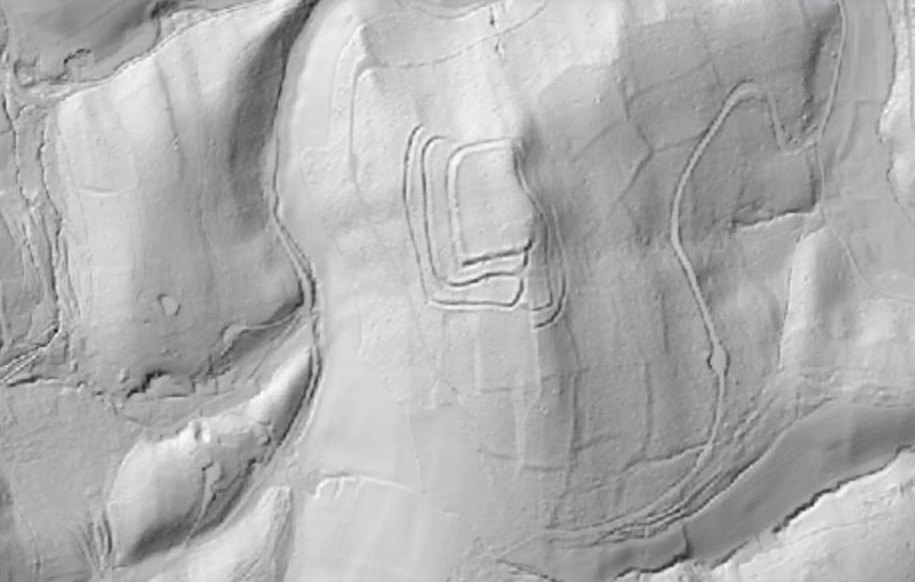
Welshbury. A rectangular circuit, and the banks of much older fields on the slope.
Go and look at one
Every hillfort mentioned here is on the map in Visit History, along with the rest of the scheduled monuments. Open the map, switch the basemap to DTM, and find the nearest one to you. Then switch back to Satellite and see how much of it you would have spotted from the air.
The ones that are hardest to see are usually the ones worth walking.