26 September 2026
How to Spot a Deserted Medieval Village From the Car
There is a field somewhere near you with nothing in it. No buildings, no ruins, nothing on the map. Walk across it and the ground is oddly lumpy, and if you are on the right side of it in the evening you can see the lumps are arranged in lines.
Around 3,000 deserted medieval villages are known in England, and that is only the ones anyone has recorded. Most of them look like nothing at all.
What you are actually looking at
A deserted village is not rubble. Medieval village houses were mostly timber, turf and thatch on low stone or earth footings, so when they were abandoned there was very little to fall down. What survives is the shape of the ground, and it is surprisingly consistent from one site to the next.
The hollow way. The village street, worn down by centuries of feet, hooves and cartwheels and then eroded further by water running along it. It usually reads as the strongest single feature: a broad shallow trench running through the site, often curving.
Crofts and tofts. Along each side of the street, a row of rectangular plots divided by low banks. The toft is the house plot at the street end, the croft is the garden or paddock behind it. Once you see one, you see the row, and the regularity is what tells you this was laid out rather than grown.
House platforms. Inside the tofts, small level terraces cut into the slope where a building stood.
A moated site or manor platform, often larger and more regular than everything around it, sometimes with a pond.
Fishponds, which are usually the most obvious earthwork on the whole site because they were dug deep and hold their shape.
Ridge and furrow all around it, because the village farmed the land and the ploughing stopped when the people left.
Gainsthorpe in Lincolnshire has most of that. From the air it is a field.
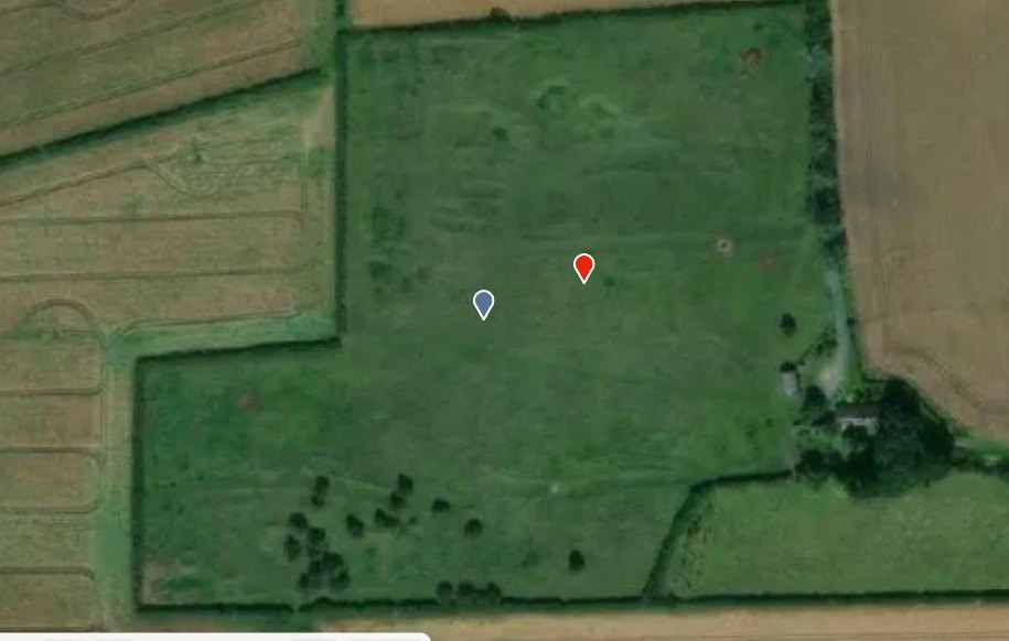
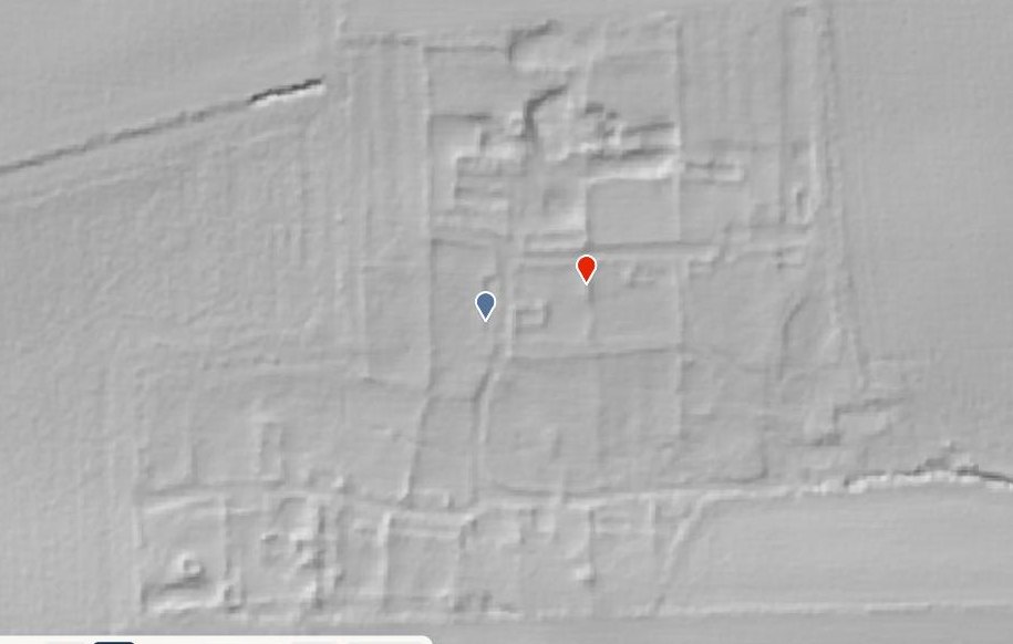
In the terrain model, the street and the plots either side of it are laid out like a plan.
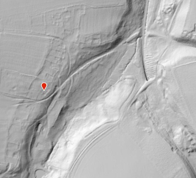
Wharram Percy in Yorkshire is the best known of all of them, largely because it was excavated for forty summers and much of what is now taught about medieval village life came out of it.
The Black Death usually is not the answer
This is the bit most people have backwards, and it is worth getting right, because it changes what these places mean.
Plague killed an enormous share of the population from 1348, and a few villages really were wiped out and never came back. But most deserted villages did not die in 1348. They limped on for a century or more with fewer and fewer households, and then went for an economic reason.
After the plague there were far fewer people to work the land and wages rose, which made arable farming with hired labour much less attractive. Wool did not need many hands. So landlords converted arable to sheep pasture, and the remaining tenants were cleared out or simply not replaced as tenancies fell in. That is the story at Old Ingarsby in Leicestershire, enclosed by Leicester Abbey in 1469.
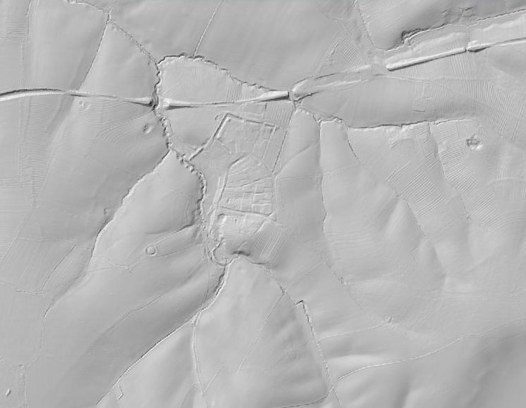
Ingarsby. The village in the middle, and its ploughing preserved all around it because nothing ever ploughed it again.
Other villages went for other reasons: a landowner emparking the grounds of a new house and moving the village out of the view, coastal erosion, a shift of the main road, or slow drift to a nearby town. Plague is part of the background rather than the cause.
What gives one away at speed
You are not going to spot house platforms from a moving car. You are looking for the signature that is visible from the road.
A church on its own in a field. This is the big one. Churches were stone and consecrated, so they outlasted the village around them by centuries. A parish church with no village, reached by a track, with a farm nearby and nothing else, is very often a deserted village with the one durable building still standing.
A field of bumps beside a churchyard, especially in evening or early morning light.
Ridge and furrow that runs right up to a bumpy patch and then stops. The ploughing respected the village while it was there.
A place name that is not a place. A signposted name with no settlement attached to it, or a farm carrying a name that sounds like a village, is worth a second look.
Two field names to watch for on old maps, if you go that far: Chapel Field and Town Field turn up on a lot of these sites.
Then check it properly
The quick way to settle it is the map. Open Visit History, switch the basemap to DTM, and look at the field. Village earthworks are one of the things LiDAR is best at, because the banks are low, regular and completely legible from above even when they are nearly invisible at ground level.
Two warnings, both learned the hard way.
Flat ground is hard. The hillshade needs a slope to work with, so a village on a level clay plain can come out far fainter than one on a valley side, even where the earthworks are well preserved.
And these sites are almost all scheduled monuments, which means they have the strongest legal protection there is. Walking a public footpath across one is fine. Digging, detecting or disturbing the ground is a criminal offence without written consent. The map is there so you know what you are standing on.
Start with the nearest lonely church.