10 October 2026
How LiDAR Sees Through Trees, and What It Cannot See
The most common thing people believe about LiDAR is that it looks underground. It does not, and the sooner that is out of the way the more useful the rest of it becomes.
LiDAR fires laser pulses at the ground from an aircraft and times how long each one takes to come back. That gives a measurement of where a surface is. It is a very good way of recording the shape of things. It is not a way of seeing through solid material, and it has nothing in common with ground penetrating radar.
So everything LiDAR finds is something that is still physically there: a bank, a hollow, a platform, a ditch that never quite filled in. It is not buried treasure. It is the shape of the ground, measured well enough that features too subtle to notice while standing on them become obvious from above.
Once you accept that, the trees make sense too.
How the trees come off
A single laser pulse going into woodland does not hit one thing. Part of it reflects off the top of the canopy, part off branches lower down, and part makes it all the way through a gap to the forest floor before bouncing back. The system records those separate returns.
That gives you two useful pictures of the same flight.
The Digital Surface Model, or DSM, keeps the first thing each pulse hit. That is the canopy, the rooftops, the hedges.
The Digital Terrain Model, or DTM, keeps the returns that reached the ground, and throws the rest away. The result is bare earth with the vegetation removed.
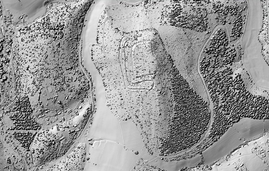
Welshbury, on the edge of the Forest of Dean, shows the three stages as clearly as anywhere. From the air it is a wood on a hill.
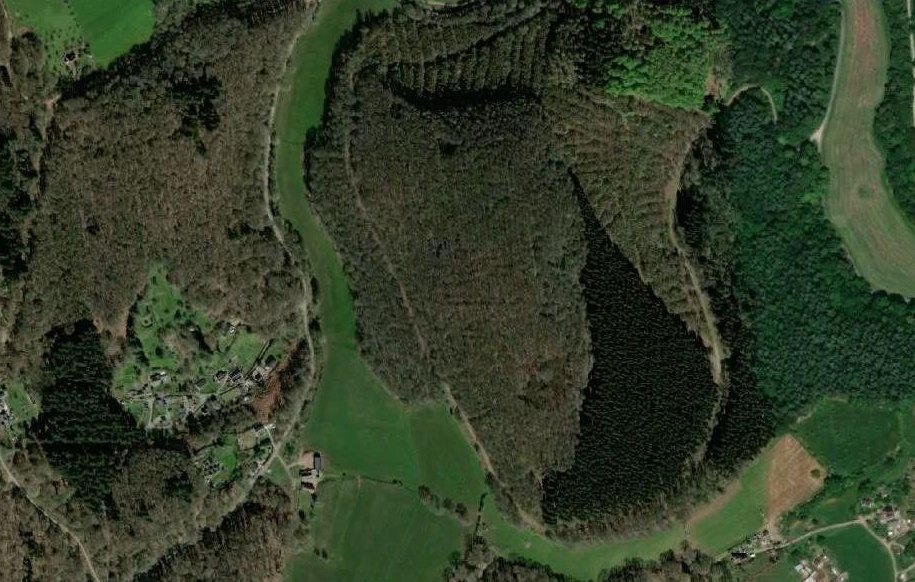
In the surface model, every tree crown comes out as a separate knobble. The ramparts are already showing through the gaps, because broadleaf woodland lets a share of the pulses reach the ground, but what you are looking at is mostly trees.
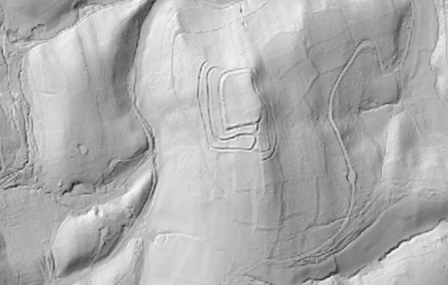
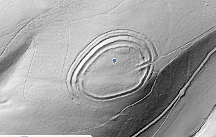
And in the terrain model there is an Iron Age hillfort on top of the hill, with the banks of much older fields running down the slope below it.
Bury Ditches in Shropshire is a useful comparison, because the fort itself is not under trees at all. It was planted over with conifers, storms in the 1970s brought them down on the hilltop, and the rest were cleared. The plantation still stands round it. In the surface model the rings sit in a clearing with the conifers packed in around them.
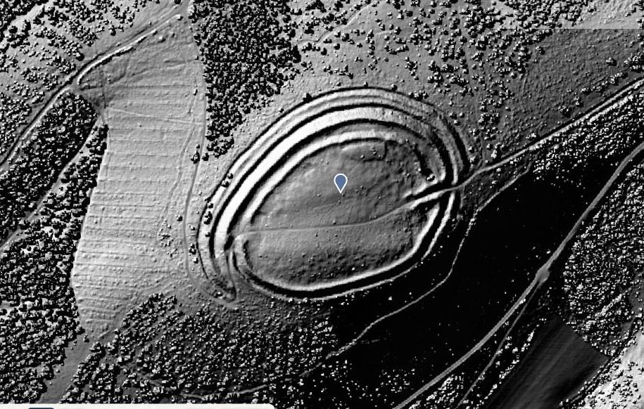
The terrain model takes the plantation off and leaves the rings where they were.
What it cannot see
This is the part that gets left out, and it matters, because knowing the limits is what stops you misreading the picture.
Anything too shallow. England's LiDAR is published on a one metre grid, so a feature has to be both wide enough and deep enough to show up as a change in height. The Uffington White Horse is the perfect demonstration. It is the most photographed prehistoric figure in England, it is 110 metres long, and it is invisible in LiDAR, because a chalk figure cut a few inches into turf barely changes the shape of the hillside at all. The hillfort thirty metres away is unmissable.
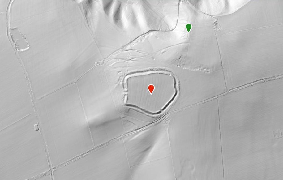
The rampart circuit is obvious. The White Horse is on the bright slope above it, and there is no sign of it.
Anything with no surface relief left. A site that has been ploughed flat is gone as far as LiDAR is concerned, even though it may show beautifully as a crop mark in a dry summer from a light aircraft. The two techniques find different things, which is why archaeologists use both.
Flat ground. A terrain model is normally drawn as a hillshade, which is a simulated low sun throwing shadows across the surface. That works because slopes catch the light. On genuinely flat land there is very little for the shading to bite on, and real earthworks can come out so faint they are not worth looking at. We ran into this trying to film ridge and furrow at Wormleighton in Warwickshire, where the earthworks are well documented and the ground is flat clay.
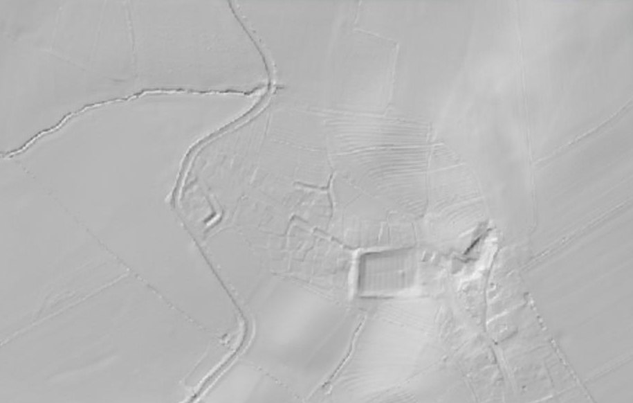
There is a deserted village and a great deal of ridge and furrow in this picture. You would not know it.
Dense evergreen cover. If almost no pulses reach the floor, there is nothing to build a terrain model from, and the software fills the gap by guessing between the points it does have. Mature conifer plantation is the usual culprit. The result looks smooth and convincing and is partly invention.
Modern ground works. Quarrying, landfill, road building and forestry ploughing all leave strong, sharp earthworks. They are the easiest things in the picture to see and one of the easiest to mistake for something old. Sharp edges and perfectly straight lines usually mean machinery.
Water, and most of Britain. Laser pulses are absorbed by water, so rivers and ponds come out as noise. And the dataset used in Visit History comes from the Environment Agency, which covers England. Scotland and Wales have their own LiDAR programmes with different coverage, so if you switch to DTM over a Welsh hillfort and see nothing, the fort is fine and the data simply is not there.
The honest summary
LiDAR is the best tool there has ever been for finding earthworks under trees and for showing how much survives in ordinary countryside. It will not find anything that has been levelled, it will not see underground, and on flat ground it can be close to useless.
That is still an extraordinary amount. Switch the basemap to DTM in Visit History and look at the woods near you. If there is a bank in there, the trees will not hide it.