14 October 2026
What Ridge and Furrow Is, and Why So Much of England Is Corduroy
Drive through the Midlands in low winter sun and you will pass field after field of long parallel ridges, running the length of the field like folds in a corduroy trouser leg. Most people notice them, decide they are something to do with drainage, and never think about it again.
They are medieval ploughing, and they are the most common archaeological earthwork in England.
How the ridges got there
Medieval ploughing used a heavy mouldboard plough, which turns the soil over to one side rather than just cutting through it. Pull that up and down the same strip of land, always turning the soil inwards, and the middle of the strip gets a little higher every year. Do it for two or three hundred years and you get a ridge that can stand a metre above the furrow beside it.
The ridges were useful as well as accidental. The furrows drained water off heavy clay, and on wet ground the crop on the ridge stood a better chance. But the shape is mostly a by-product of doing the same thing in the same place for a very long time.
Each ridge, or a small group of them, was a strip, and strips were the unit that land was held in. A village's arable land lay in two or three enormous open fields with no hedges, divided into hundreds of strips, and a household's holding was scattered across them rather than being in one block. That sounds inefficient and was partly the point: it spread everyone's risk across good ground and bad.
The standard length is where the word furlong comes from. A furlong is a furrow long, about 220 yards, which is roughly how far an ox team could pull before it needed a rest and a turn.
Why they curve
Look along a length of ridge and furrow and you will often see it is not straight. It swings in a long shallow reverse S, drifting left at one end and right at the other.
That is the turning circle. A plough team could be eight oxen long, and a team that size cannot turn on the spot. The ploughman had to start swinging the team to the left before reaching the headland at the end, and the plough followed. Every pass repeated the same curve, and the ridge froze it.
The reverse S is the single most reliable way to tell medieval ploughing from anything modern. Modern tramlines and drainage runs are dead straight, because tractors turn tightly.
Why any of it survives
This is the part that makes ridge and furrow worth paying attention to.
The ridges only survive where the land stopped being ploughed. Run a modern plough over them a few times and they are gone. So a field with ridge and furrow in it is a field that went down to grass at some point in the past and was never brought back, and that is a piece of history in itself.
Often the reason was sheep. Wool was worth more than corn for long stretches of the later Middle Ages, and landlords converted arable to pasture, which usually meant the people who farmed it had to go.
Old Ingarsby in Leicestershire is a clear case. Leicester Abbey enclosed the parish for sheep in 1469. From the air today it is ordinary grass fields.
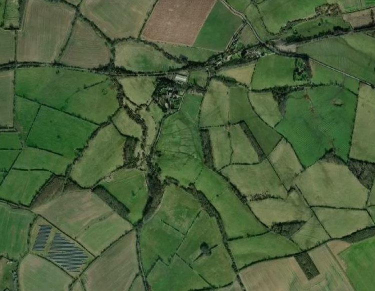
In the terrain model, almost every field is corduroy, and the blocky earthworks in the middle are the village that was cleared.
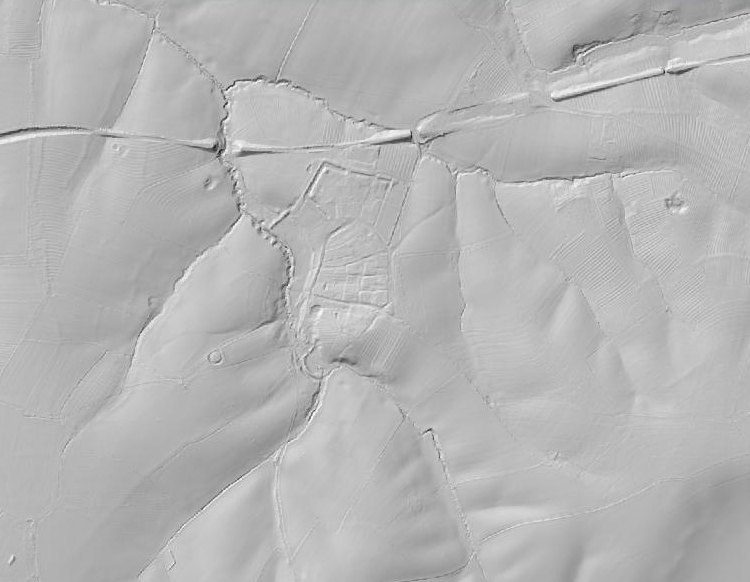
Ridge and furrow across most of the frame, with the crofts and hollow way of the deserted village in the centre.
It does not always show up
Honesty about the technique matters as much as the technique. Ridge and furrow is low, often less than a metre, and LiDAR hillshading needs a slope to throw a shadow across. On flat ground it can be almost invisible even where it definitely exists.
Wormleighton in Warwickshire is the example that taught us this. It is a famous deserted village with extensive surviving ridge and furrow, and on flat Warwickshire clay the terrain model shows almost nothing.
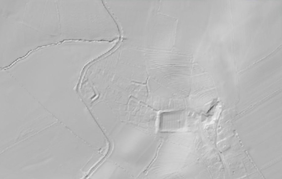
Ingarsby works because it lies on a valley side. If you look for ridge and furrow near you and find nothing, try somewhere with a slope before concluding there is none.
Spotting it without a computer
The earthworks are shallow, so it is all about light and water.
- Low sun, early or late in the day, and best in winter. Shadow in the furrows is what makes the pattern jump out.
- Frost and snow, which linger in the furrows after they have gone from the ridges, so the field reads as stripes.
- Standing water after heavy rain, for the same reason.
- A slope facing you, so you are looking across the ridges rather than along them.
Then check the curve. If the lines bend in a long reverse S, you are looking at something a person walked behind an ox team to make, some time before the fields you are standing in existed.
Have a look at your own area
Open the map in Visit History, switch the basemap to DTM, and find a patch of old pasture near you, ideally on a slope. Then switch to Satellite and see whether you would have known.
Most of England was farmed this way. The interesting question is not where the ridge and furrow is. It is which fields kept it, and what happened to the people who used to plough them.