What LiDAR shows that a map cannot
LiDAR (Light Detection and Ranging) is a laser survey flown from aircraft. It measures the height of the ground millions of times over, producing an elevation model precise enough to pick out a ditch, a bank or a buried building platform. Rendered as a hillshade, it makes the landscape look raking-lit at dawn, and centuries of earthworks stand out in relief: hillfort ramparts, ridge and furrow, deserted medieval villages, mine workings and field systems that are invisible on the standard map and often invisible from the ground.
Visit History includes the Environment Agency's national composite for England at 1 metre resolution, in two forms:
- DSM (Digital Surface Model) records everything the laser hit, including trees, hedges and buildings. Useful for context and for sites where the structures themselves matter.
- DTM (Digital Terrain Model) strips the surface objects away and shows the bare earth. This is the archaeologist's view: earthworks hidden under woodland appear as if the trees were never there.
Coverage is England only, which is where the Environment Agency's survey runs.
Using LiDAR in the app
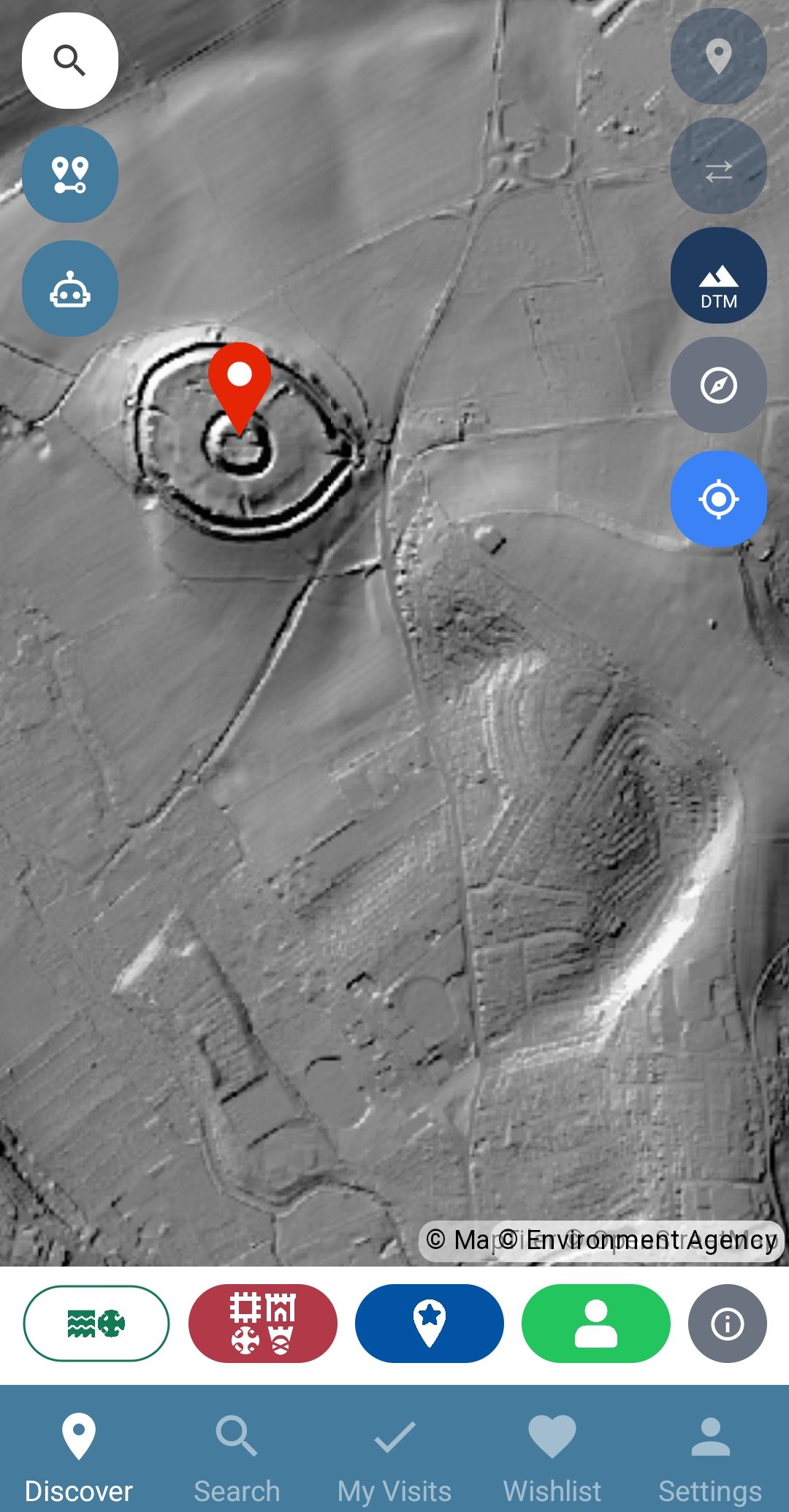
Open the map and tap the LiDAR button on the right-hand side. It cycles from off to DSM to DTM, so two taps takes you to the bare-earth view. The overlay draws on top of wherever you are looking, and every site pin stays in place, so you can put a scheduled monument pin next to the earthwork that earned it.
Try it over Old Sarum, pictured here: the concentric ramparts of the Iron Age hillfort and the footprint of the old cathedral leap out of the terrain model, where the street map shows a green field.
Using LiDAR in your browser
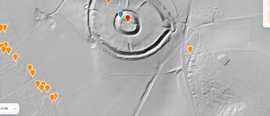
The web map explorer has the same two models on the DSM and DTM buttons in the view bar, with something the phone screen is too small for: the big-screen compare tools. Swipe drags a divider between the LiDAR and any other view, and side-by-side locks two maps to the same place, so you can hold the terrain model against the street map, or against a Victorian survey from the historic map overlays.
What to look for
- Hillforts: rings of banks and ditches, often clearest on the DTM where trees cover the slopes.
- Ridge and furrow: the corduroy stripes of medieval ploughing, surviving in pasture that has never been ploughed flat.
- Deserted settlements: house platforms, hollow ways and closes where a village once stood.
- Mining and quarrying: bell pits, spoil heaps and leats, especially across the uplands.
Switch on the Scheduled monuments layer while you explore: where a pin sits on empty ground, the DTM usually shows you why it is there.